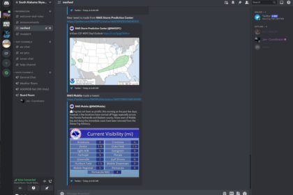
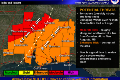
Severe Weather Expected Wed Mar 30, 2022

Spotter activation will be needed Wednesday night into Thursday morning as a squall line moves through our area. Conditions will be extremely favorable for tornadoes and strong winds. Everyone is advised to have means of getting weather alerts as warnings may be on short notice.

Wed 03/17/2021

Severe storms are looking increasingly likely across our area Wednesday and Wednesday night. There is an Enhanced risk of severe weather along and northwest of a Luverne, AL to Brewton, AL to Bayou La Batre, AL line, with a Slight Risk further east. The timing Read More …

Cristobal

Spotters will be needed beginning Sunday 7AM until 7AM Monday morning or conclusion of the event. The primary threats will be coastal flooding, coastal winds, inland wind gusts, flash flooding, and the possibility of an isolated tornado or two.

Sunday 04/12/2020

Hazardous Weather Outlook National Weather Service Mobile AL 530 AM CDT Sun Apr 12 2020 ALZ265-266-FLZ202-204-206-131030- Mobile Coastal-Baldwin Coastal-Escambia Coastal-Santa Rosa Coastal- Okaloosa Coastal- 530 AM CDT Sun Apr 12 2020 …HIGH RIP CURRENT RISK IN EFFECT THROUGH TUESDAY MORNING… …COASTAL FLOOD ADVISORY IN EFFECT Read More …